Juntos en la Historia: los mapas de Canadá en las colecciones españolas
Join us for this cartographic exhibition and lecture by Professor F. Álvaro Durántez
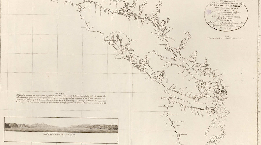
The exhibition Together in history: the maps of Canada in the Spanish collections features 17 Spanish historical maps and illustrations that reflect and detail important spaces of the current territory of Canada and the northernmost America.
They have been provided by the National Geographic Institute of Spain, the National Library of Spain and the Naval Museum. These illustrations and cartographic representations show the deep transatlantic vocation and the wide projection of Spain in the Pacific, as well as the active and committed Spanish look at Canada since centuries ago.
The exhibition is curated by the specialist and academician F. Álvaro Durántez, who will travel to Canada for the inauguration, which will be completed with a descriptive and explanatory conference.
The conference is in Spanish only; RSVP required at [email protected] as space is limited.
- Visual arts
- Ottawa
- Tue, May 24, 2022
- 6:00 pm – 8:00 pm
2 years ago
Venue
Embassy of Spain, 74 Stanley Avenue, Ottawa ON K1M 1P4